Testing the Wings: From Par to Polkerris
LOCATION: Par Beach, St Austell
DATE: 30th November 2025
I recently managed to get my hands on a DJI Air 3, thanks to my father kindly passing it on for an absolute bargain. With a rare break in the Cornish wind, we headed down to Par Beach to see what this new kit could really do.
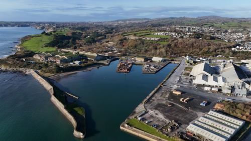
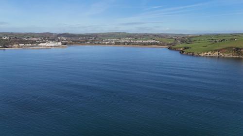
Par Beach is a fascinating spot for a maiden flight; known for its expansive sands and the striking industrial backdrop of the china clay works, it offers a vast, open airspace that is perfect for testing range. Unlike many of the steeper cliffs in the area, the level dunes and wide horizon provide a clear line of sight for miles.
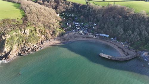
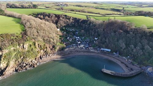
It was only a quick test flight, but the performance difference was staggering. Soaring from a bench at Par and being able to optically zoom in on the pub at Polkerris within seconds was a massive leap forward. It’s a completely different world compared to the DJI Flip drones we are used to flying—the stability and reach of the Air 3 are game-changers.
Cornwall’s Lunar Landscape
The landscape surrounding the St Austell area offers some of the most surreal and visually striking footage in our portfolio. Known for its stark whites and deep turquoises, the Clay Country provides a dramatic, otherworldly backdrop where industrial history and natural recovery meet.
The Iconic Sky Tip
The Carluddon Sky Tip is the undisputed landmark of this region. Often called "The Cornish Alps," this towering conical peak is a monument to the generations who worked the local china clay pits. From the air, its sharp geometry provides a perfect focal point against the surrounding moorland.
The area is a fascinating mix of heritage and modern progress, with sites like Eden Reclamation sitting alongside innovative green energy projects.
A World of Deep Water and Stone
One of the most striking features to capture from above is the collection of "clay lakes" scattered throughout the terrain. Baal Lake and Pentruff Lake are standout examples. Their waters are incredibly still and often take on a vibrant, milky blue hue due to the mineral deposits from the mining process.
Through our drone lens, we love to showcase the contrast between these sapphire waters and the rugged white quartz sand that surrounds them. It is a place where nature is slowly reclaiming the old workings, creating a unique wilderness that is as beautiful as it is historical.
Where History Meets Our Horizon
The Gover Viaduct is quite literally our backyard. We find ourselves drawn to filming here constantly; there is something uniquely convenient and captivating about being able to take off from our garden and immediately capture the sheer scale of the viaduct set against the stunning, rolling scenery of the valley.
A Legacy of Stone and Steam
The viaduct you see today is a testament to Victorian engineering, but it wasn't always this way. It stands on the site of one of Isambard Kingdom Brunel’s original timber-fanned structures. In the late 19th century, those iconic wooden trestles were replaced by the robust, towering stone arches that now define our skyline.
Constructed primarily of local stone and brick, the Gover Viaduct served as a vital link for the Cornwall Railway, facilitating the transport of china clay and passengers through the heart of the county.
The Heart of the Valley
Gover Valley itself is a hidden gem of St Austell. While the viaduct represents industrial ambition, the valley below is a sanctuary of natural beauty. It was once a hive of activity—not just for the railway, but for the nearby tin mines and clay works that fueled the local economy.
Today, the valley has returned to a state of tranquil wilderness. Through our drone lens, we aim to capture this intersection: the permanent, silent strength of the railway arches soaring over the ever-changing, seasonal colors of the Cornish countryside.